World Map With Countries: History Of Your Travels In An Interactive Format
Traveling allows a person to develop, see the world, open new horizons, and be inspired. All this has a very positive effect on attitude towards oneself, physical form and psychological state. In addition, trips reveal a person from a new side, which he may not be aware of. Therefore, in order not to forget anything after traveling, we recommend that you create a world map of visited countries.
A personal map of visited countries is a great way to keep your travel history. The map is created online. The result can be saved or shared using a link.
Your own map of the world with countries can have any color scheme, it is created in a matter of minutes online and is available for download. This is your personal travel story.
World Map with Countries: Interactive Travel Diary
The world map with the traveler's personal data is a time capsule that preserves the history of your life. In the age of high technology, such a map does not have to be drawn by hand, but can be created online, stored and edited from any device, computer or smartphone.
An interactive map of visited countries is created online in just a few mouse clicks. You can devote the whole evening to the process or a few minutes: it's up to you to choose.
The result of your work is saved on the network and is available at any time via an individual link. The resource that stores the history of your travels is accessible from any smartphone, tablet, laptop or desktop computer. The map is all with you! It is convenient, simple and functional.
Where and how you can use your own map of the world with visited countries
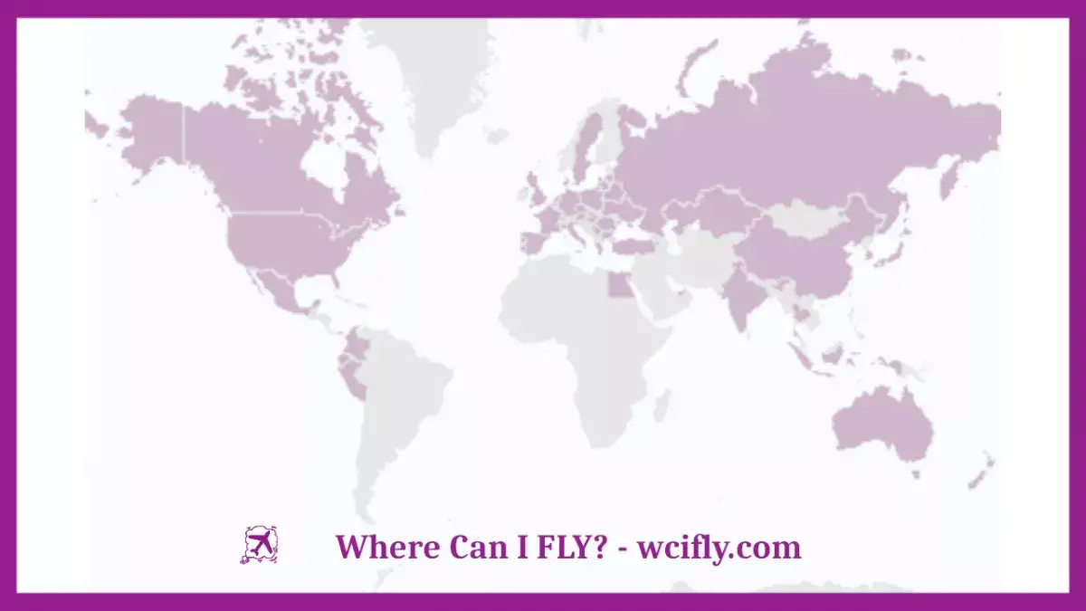
An interactive map of the world with the countries you have visited - a functional information and art object.
First of all, such a map of the world with countries will help you analyze the geography of your travels:
- the map clearly shows which regions you visited most often;
- you will be able to identify the types of countries you are most interested in;
- with a map it is easier to see which continents have not been visited.
The world map with visited countries is an ideal art object for decorating a travel blog:
- use the link to the interactive map in the pinned post on social networks;
- share your travel history in posts, conferences or group conversations;
- use the saved image in your blog design (header, background, stories).
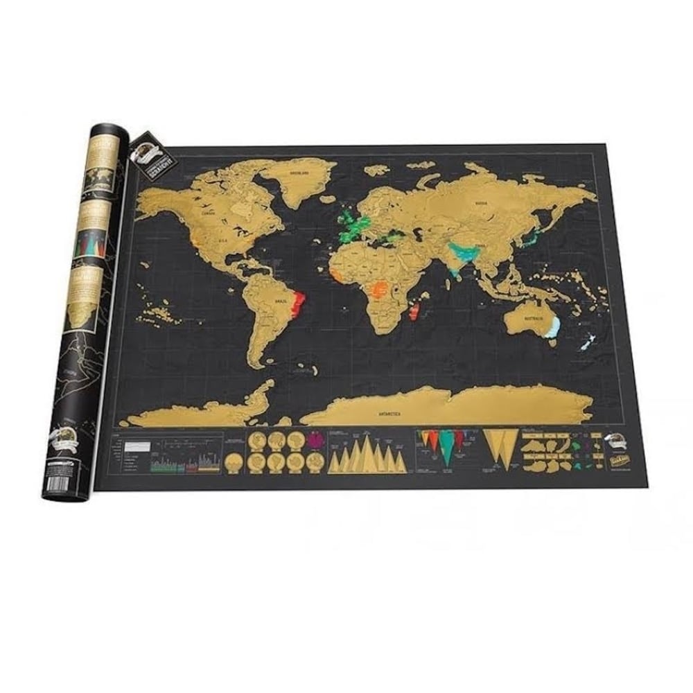
The printed map can be used to decorate the interior of your apartment or house. Insert the image into a designer frame and place it in your living room or office. The history of your travels can be a great topic of conversation and a pleasant interaction for guests.
The image of the card can be printed on the cover of the diary, T-shirt, mug, tablecloth or photo wallpaper. This unique design element will become a highlight of your interior and decorate your everyday items.
An interactive map of the world with countries is part of the image of a modern person leading an active lifestyle. You can use the map information in your portfolio to talk about hobbies and hobbies. The formation of such a map online will show your desire for order and analysis, qualities that are extremely useful in any work.
Varieties of world maps with countries for travelers
The advantage of interactive maps of the world with visited countries is their uniqueness. Everyone can make for themselves an individual design of the finished card. In this case, the format of the future card for use may be different:
- link available version;
- saved electronic image;
- printed version.
To share the electronic version, copy the link to it to the clipboard from the map designer page and paste it into your post. On the site you will find hot links in order to share the finished result on popular social networks. You can download the picture on your PC by clicking on the corresponding link.
A block of links for saving and publishing the result is at the bottom of the map constructor page.
To print a map, choose thick paper: this will make the image look more solid. Laminated paper will make the finished card more durable and attractive.
Visited Countries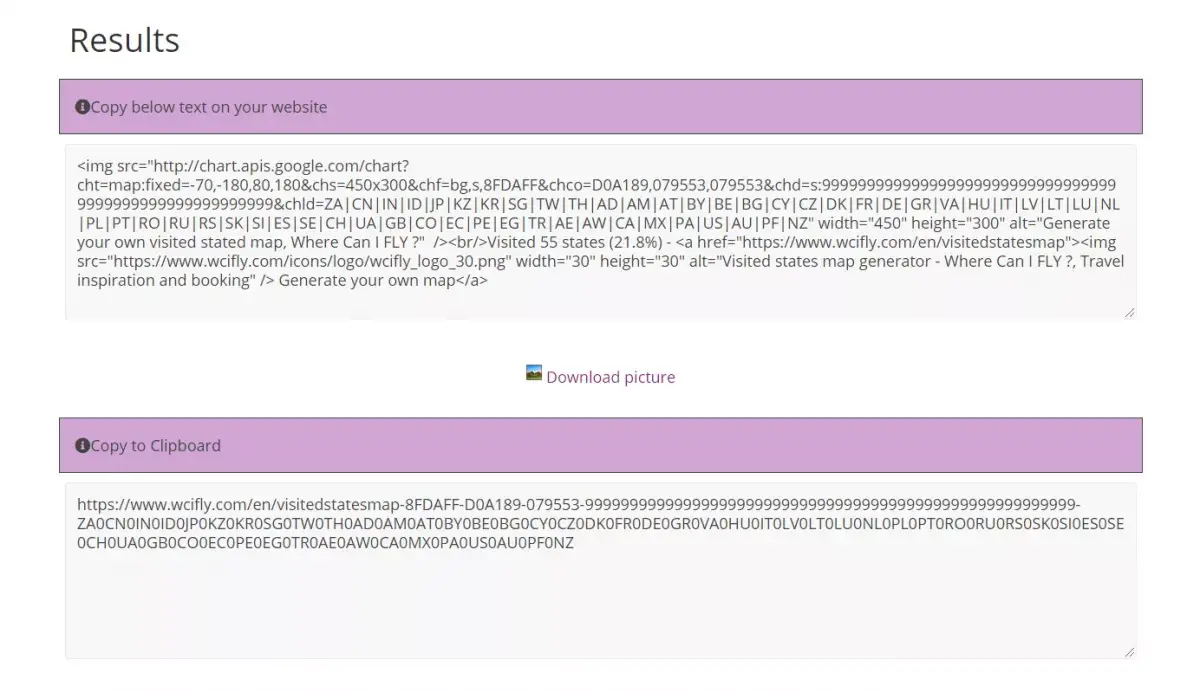
How to draw up your own map of the world with countries for a traveler
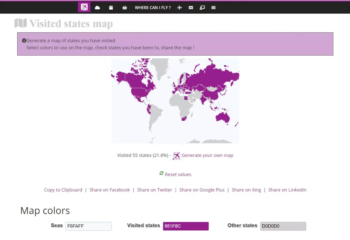
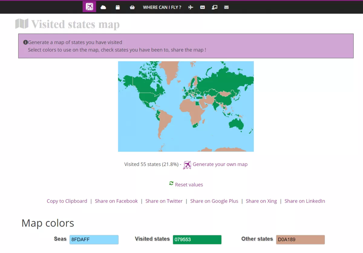
The possibilities of the service for creating interactive maps with the regions and countries you have visited are very wide. To create a beautiful, understandable and impressive map for viewers, pay attention to the color selection:
- to indicate visited states, it is best to choose bright juicy colors, but not aggressive (red or yellow is not the best choice);
- the color that will be painted over other countries is best done neutral, light gray or pale green;
- It is customary to highlight seas and oceans in blue or light blue, but not dark, but a light shade, otherwise the map will look too gloomy.
At the top of the resource page, you can track how the world map with countries changes after you add new states to its canvas.
To quickly find the country you need, select a region using the link from the list at the top of the constructor. If you are not satisfied with the result and want to start creating a map from scratch, click on the Reset Values link.
Try several color combinations before filling out the entire card. This will save you time and effort in creating a great final image.
A world map of the countries you have visited, electronic or printed on paper, is a great way to plan trips, save their progress and share the results with loved ones.
Frequently Asked Questions
- How does an interactive world map with countries help travelers document and share their travel history, and what features make these maps appealing?
- An interactive world map allows travelers to mark countries they’ve visited, creating a visual travel history. Features like customizable pins, travel notes, and sharing capabilities make these maps appealing for documenting and sharing travel experiences with others.